trinity riverfront
The Dallas Trinity Riverfront plan is a strategy and vision for Dallas’ future, one that reunites the city with its river and sets the stage for transformation. The plan intensifies the existing qualities of Dallas’ urban and natural landscapes and, in so doing, helps to realize the full potential of the region’s development opportunities and economic prosperity. The plan is about dense city districts full of energy and exuberance, and intense landscapes that play many roles – social, economic, and environmental. It builds off Dallas’ entrepreneurship, natural resources, business acumen, and diverse urban lifestyles.
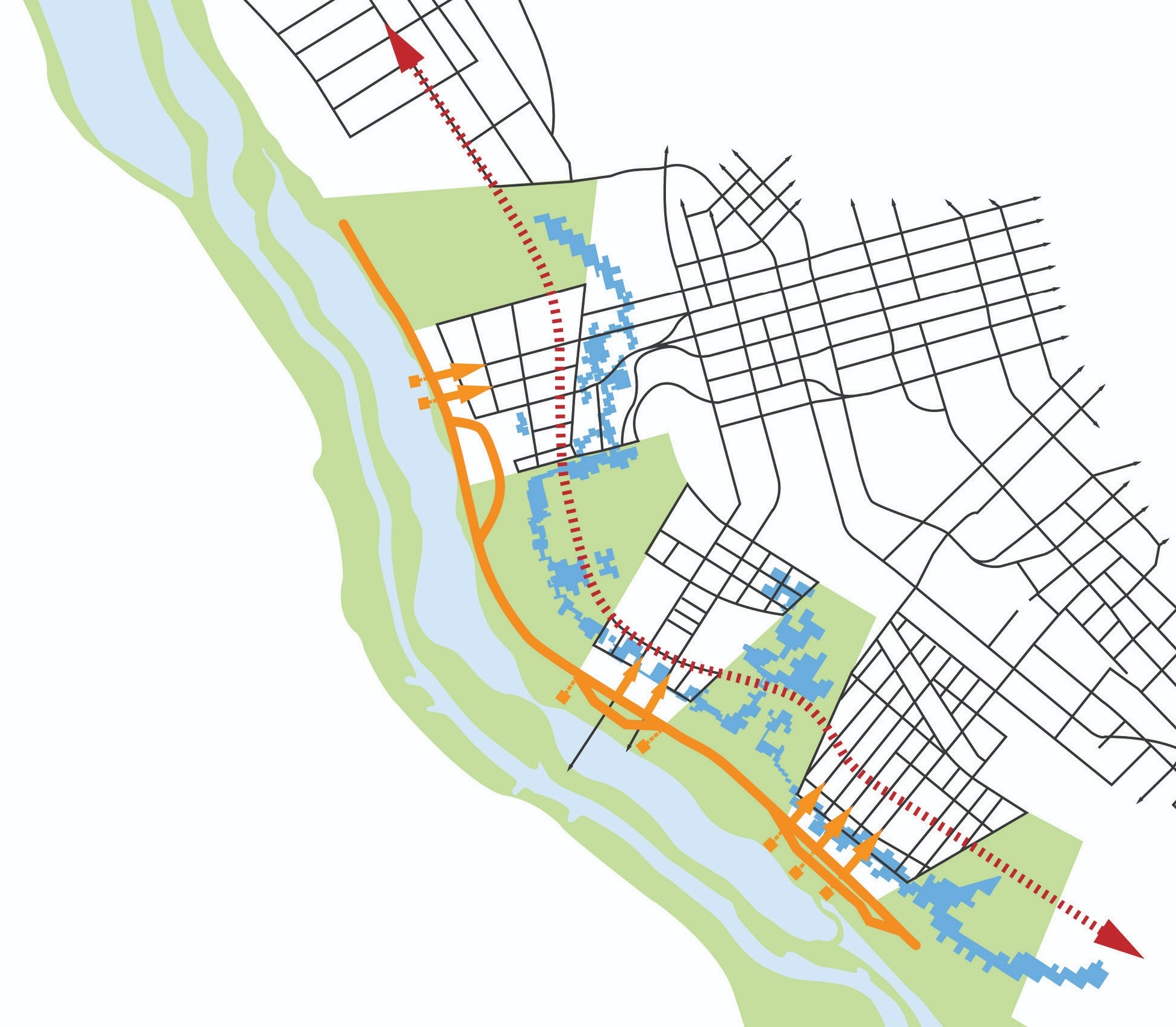
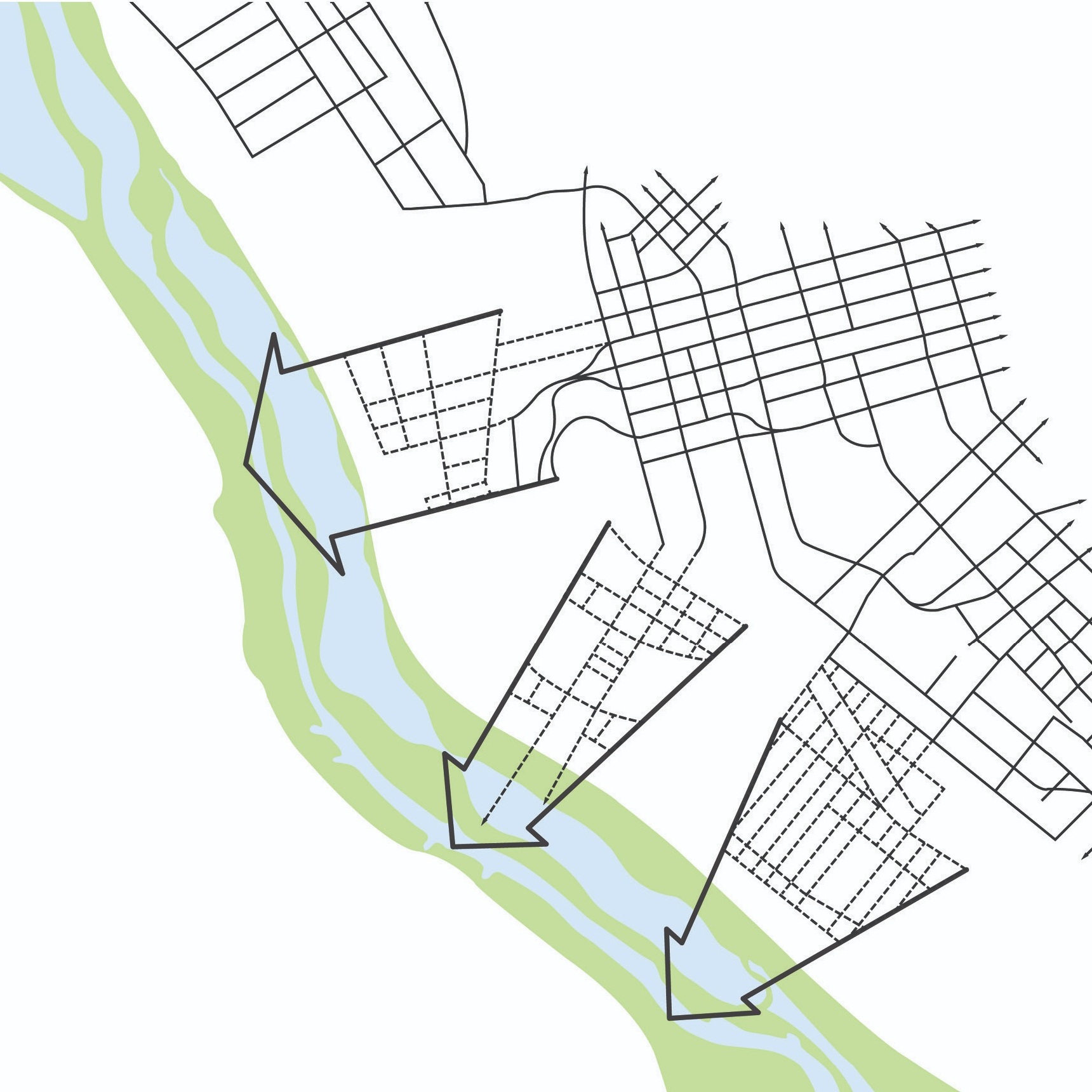
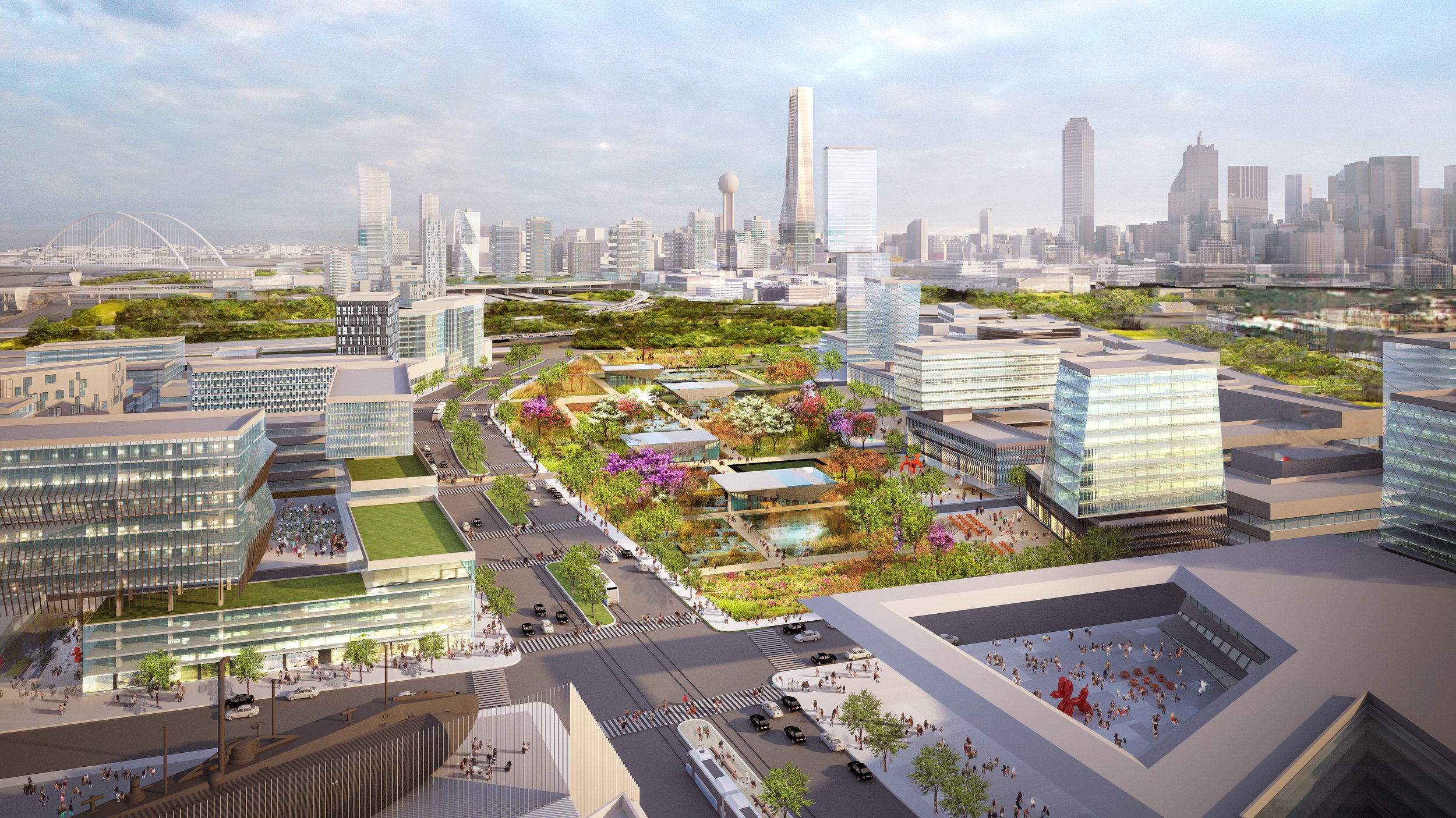
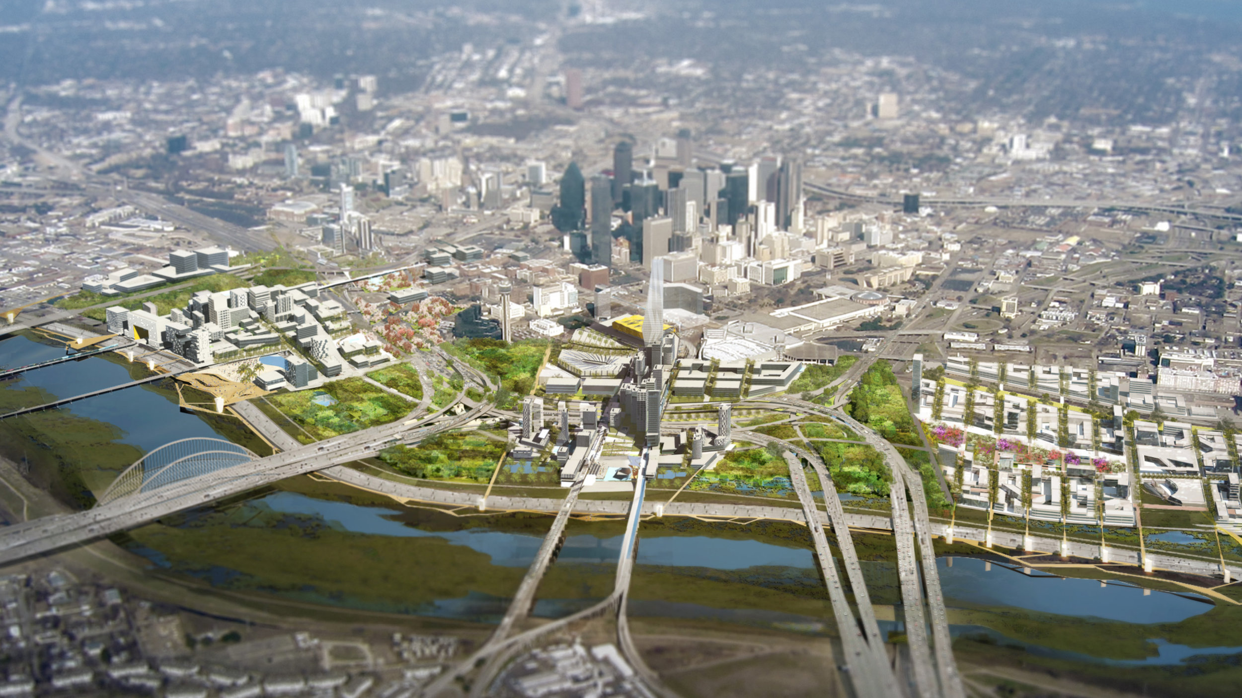
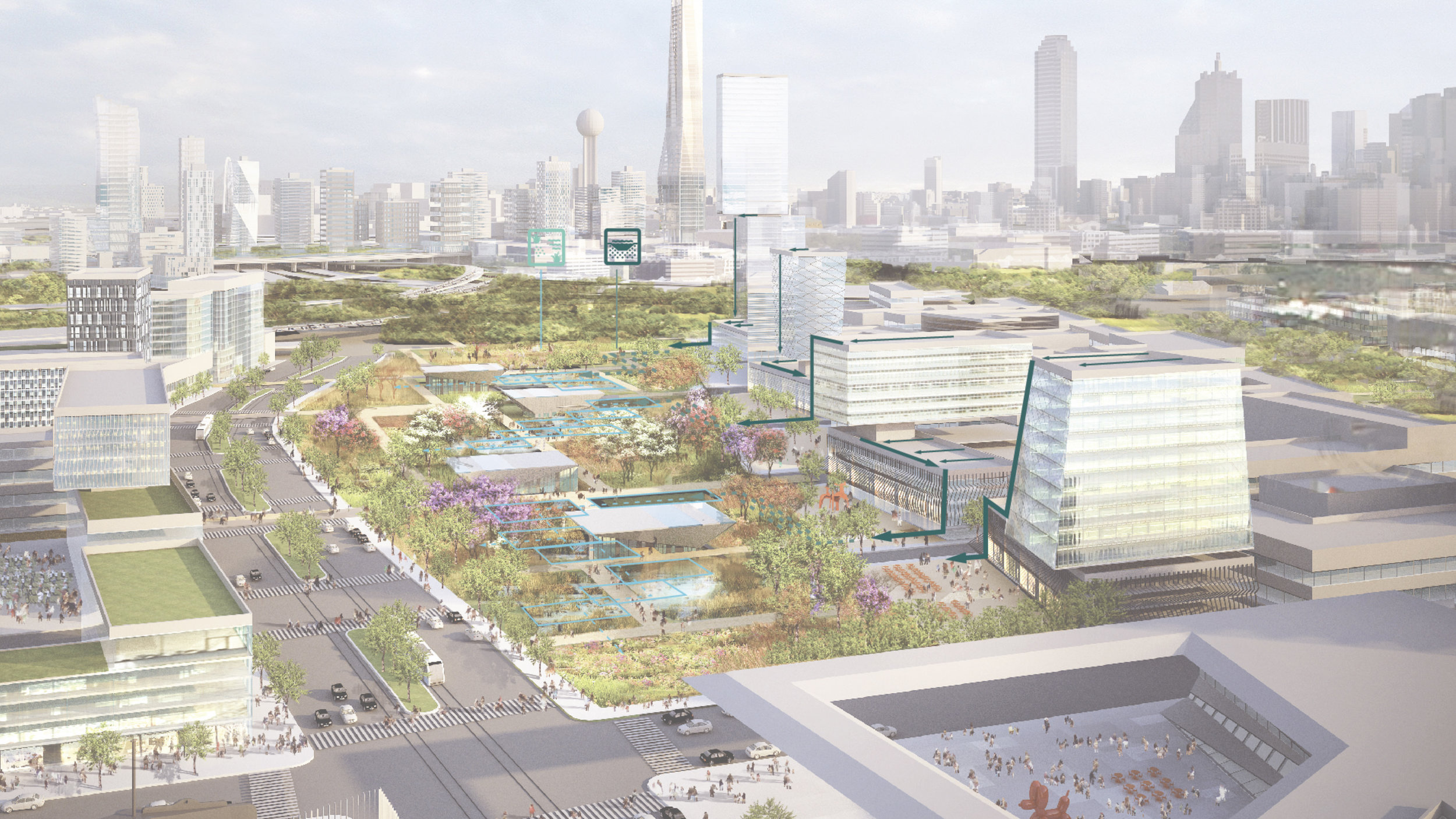
At the core of this approach are three new, dynamic, mixed-use neighborhoods interspersed within regions of variegated, programmed and sustainable landscape. The expansion of the city grid and the city green has mutually beneficial properties that make Dallas more livable, but also more vibrant, accessible and competitive. At the center of this landscape is the old Trinity River, brought back to life as an innovative series of active public spaces, wetlands and gardens that double as water filters and flood basins. These new spaces will be inter-connected with a new light-rail system along the proposed toll-road, making the Trinity floodplain the most exciting public space in Texas.
This project intensifies the growing energy and vibrancy in the heart of Dallas, where people live, work, and play, and thrives on spontaneous and unexpected interactions. It brings the experience of nature directly to people’s doorstep, allowing for urban and landscape experiences not possible elsewhere, as well as filling in spaces (like transportation rights-of-way) that urban development cannot.
Timeline
2014—2015
Status
Complete
Size
489 acres
client
Connected City Design Studio
location
Dallas, TX
TEAM
Stoss
SHoP Architects
James Lima Planning + Development
NelsonNygaard
Gresham, Smith & Partners
LimnoTech
Buro Happold
ETM Associates, LLC